Glacier National Park.
Another delightful day, this time in Glacier National Park, where Bev visited with BGC twice, in 2004 and again in 2010.

The landscape is pretty flat, for the most part, in this part of Montana, but as I got closer to Glacier National Park, mountains started to pop up — the Rockies, of course, which in Glacier consists of the Clark, Lewis, and Livingston Ranges. This is why the Cut Bank town sign reads “where the Rockies meet the Plains.”
The park is pretty damn big, although half the size of Yellowstone, consisting of about one million acres over 1,500 square miles, and actually enters Canada, becoming Waterton National Park at that point, and the park flies both the US and Canadian flags.


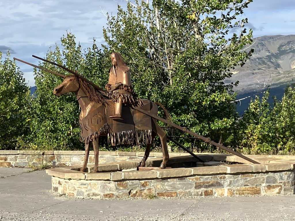
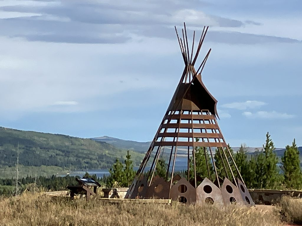
Nearing the park, besides the increasingly looming Rockies, there is a site describing the Blackfeet territory that road is passing through, and a couple of lovely statues commemorating the Blackfeet way of life.
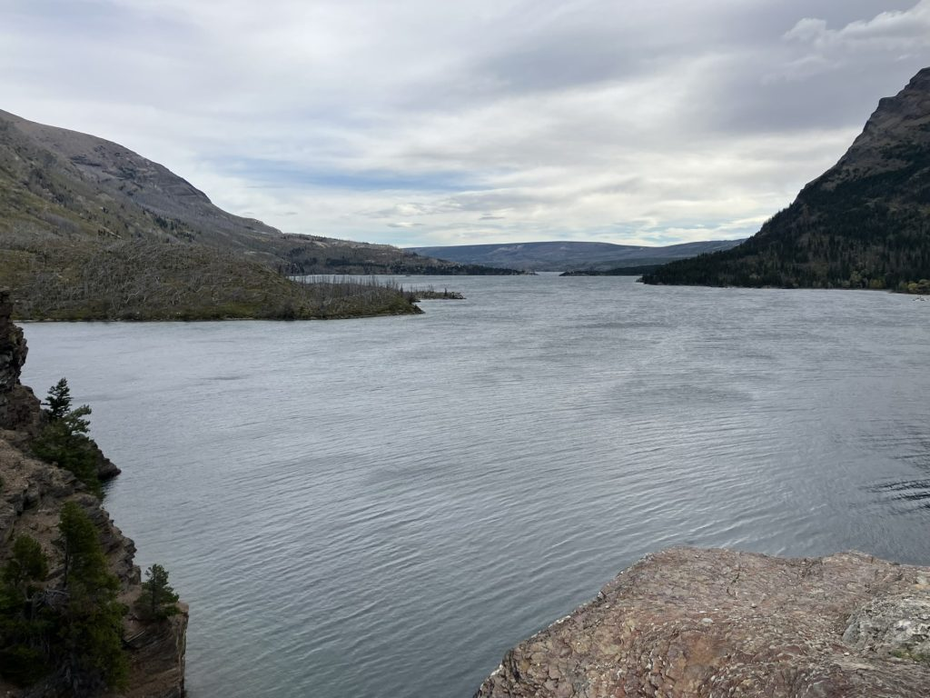
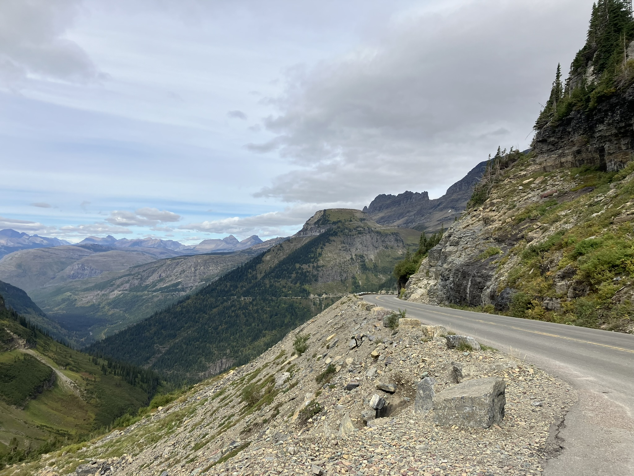
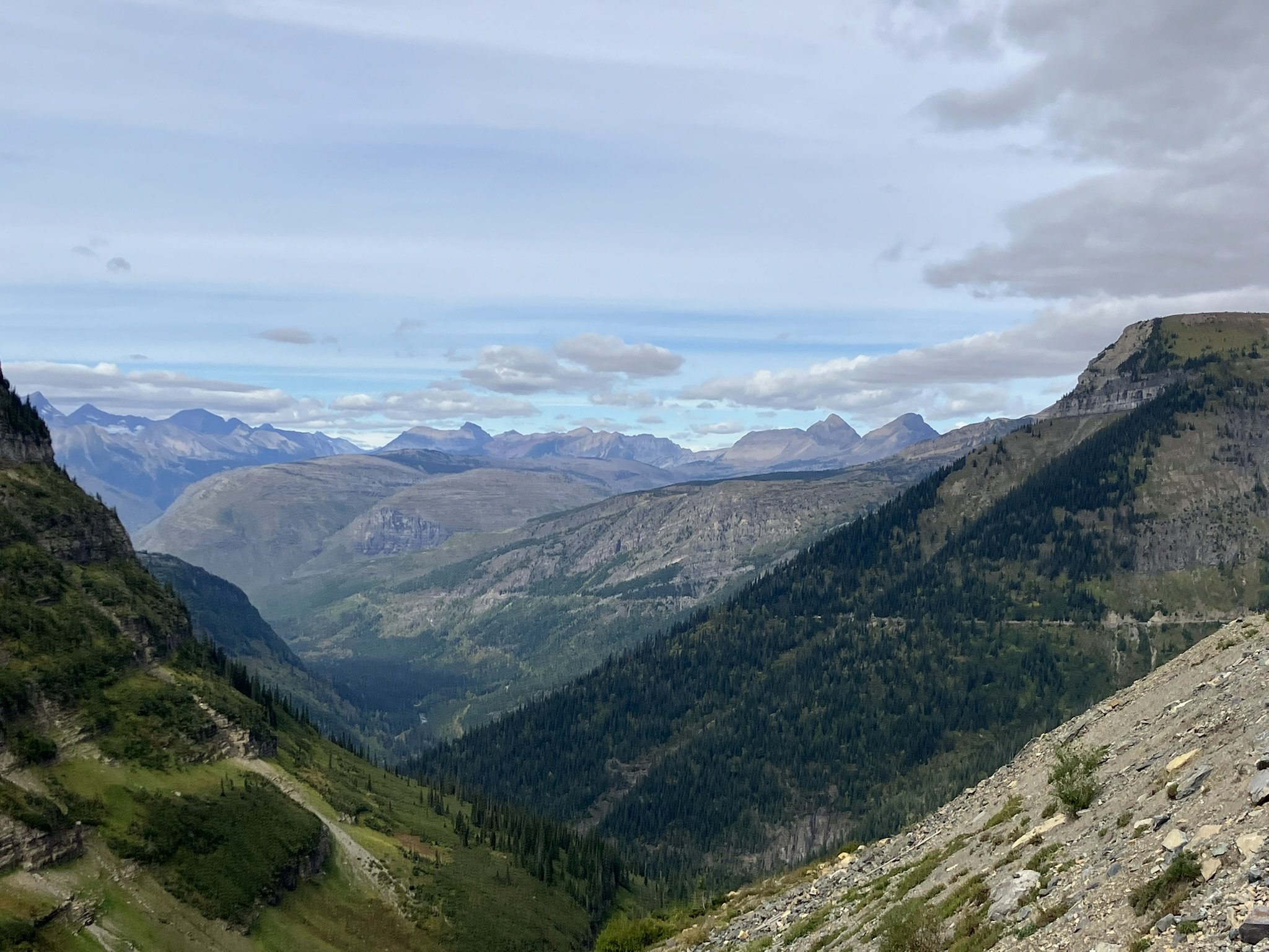
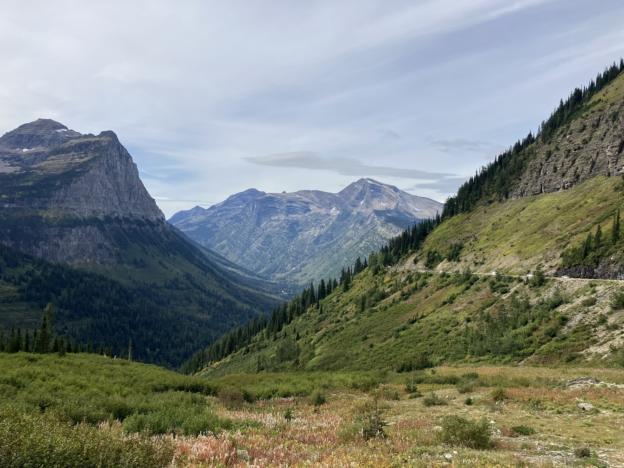
And then Glacier National Park, which is yet another incredible park, characterized by the looming Rockies, as well as it’s two major lakes, St. Mary as you enter through the main entrance, and further south, McDonald Lake, which is the larger of the two. However, most of the park is accessible only by foot, and I think only about 20 percent or so by car, with the Going-to-the-Sun road as the main route running about 50 miles from north to south. I found only a few off roads that I could travel, but perhaps had I explored a little more I may have found a few more. Still, it’s clear that the Sun Road is the main focus for driving through the park, and is a beautiful road, running up through Logan Pass, to about 6,600 feet, where it crosses my old friend, the Continental Divide (so, we meet again).


Soon after the lake, comes Sun Point, a lovely, and very, very windy, at least when I was there, viewing point with beautiful views of the lake, I do mean windy, and cold also, and happily I was equipped with wool socks, a wool hat, and a double fleece layer. It was really a cutting wind, that could almost knock you over.

From Sun Point, there’s a nice trail that goes to three different falls, Baring Falls, St. Mary Falls, and Virginia Falls trails, with Virginia Falls the furthest away and the most arduous as it goes uphill quite a ways, i think. I started along that trail, first visiting the Sunrift Gorge, along a short side trail, and then planning to head further along to the first of the three falls. I never actually past the Sunrift Gorge, though.
But along the trail, I released some more of Bev’s ashes, off the side of the trail, and over St. Mary Lake. As I hadn’t planned to come to Glacier, until I realized how close by it was, I hadn’t thought about releasing any of Bev’s ashes here. So, even though I thought I had completed that part of my journey, I was happy to release more ashes here today.

At Sunrift, a young guy, well equipped for photography and hiking, asked me if I could give him a ride to his jeep, parked near Logan Pass, about 4 miles away, and I agreed. So, instead of continuing to Baring Falls, we walked together back to the Sun Point parking area, where i gave him a lift. All in all, the little hike was probably about 1½ miles, less than I’d planned, but just as well, as I ran out of water before entering the park and hadn’t been able to find any water for sale in the park at the various visitor centers (they sell clothing and books, but no water). It wasn’t that the water was needed because of the heat, as it was still quite cool, but definitely for general thirst and hydration. For that reason, although I kept looking for somewhere to buy water in the park, I didn’t take any other hikes today, except for short walks, but I’ll be back tomorrow for at least a couple of hikes.
Anyway, for safety’s sake, I took a photo of the guy and his ID before letting him into my car, and made a point of telling him I’d emailed that to a friend. That seemed the prudent thing to do. It turned out okay, and he wasn’t a park killer, and I drove him to his jeep, and then stopped at the Logan Pass visitor center, where I still couldn’t get any water. I spied the Hidden Lake trail, as well as the Highline trail, both of which start out near the visitor center. Just a few days ago, a hiker was attacked by a bear on the highline drive. He was badly injured, but survived. Every trail here starts with a wanting to carry bear spray.

The views from visitor center were dramatic, even from the parking lot, and why not? It’s in the middle of all this stark beauty.


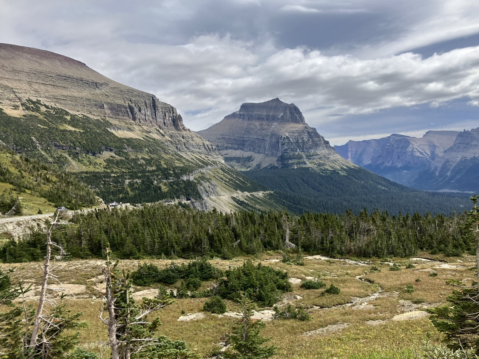
Just outside of the visitor center, which nears the top of the pass, I met up with, by now, my old traveling partner, the Continental Divide, at a little over 6,600 feet.

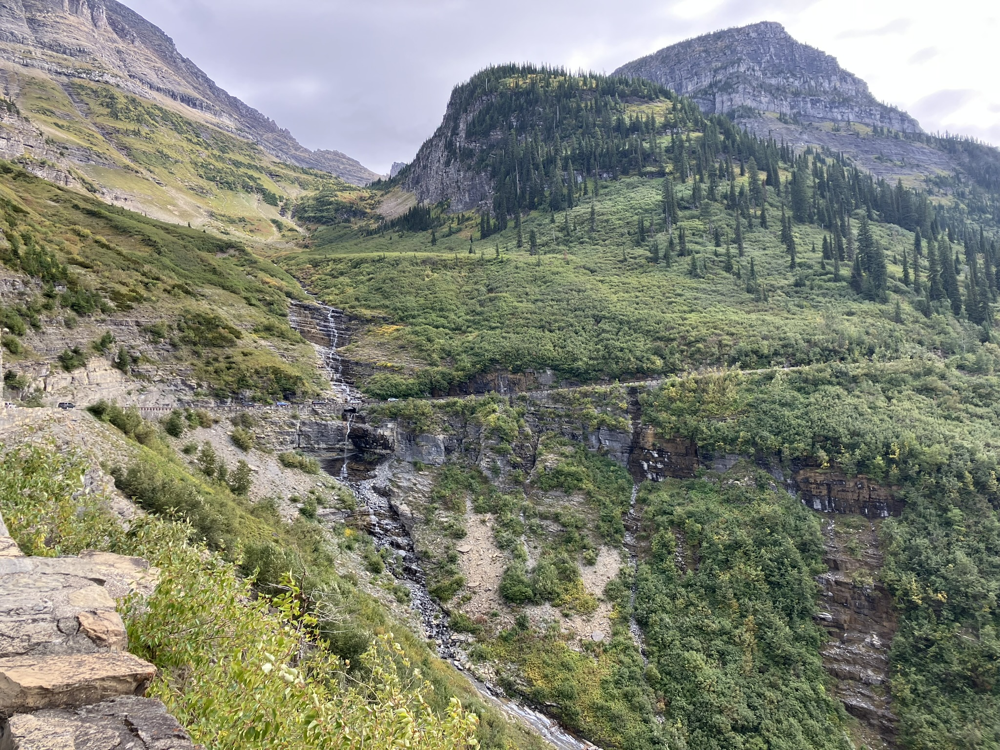
The Logan Pass is another fun, and dangerous road, although much less so than some of the other mountain and mountain pass roads I’ve drive, but still filled with s-curves and u-turns looming over fields, mountainous hills, and valleys below. Great views, of course.


I drove down to the very end of Going to the Sun road, about 50 miles, and finally did find a store that sold water, as well as bear spray, for $49, which I bought as i still thought I might hike today. But, other than small walks I didn’t, but I’ll have the bear spray for tomorrow, although hardly imagine I’ll need it. But you never know. The hiker and photographer I picked up earlier carried a can on his belt, and had a spare in his backpack, and said he’d come close to bear many times, as he looks for wild life to photograph, and said he’d used the spray on one occasion, which instantly turned the bear around.
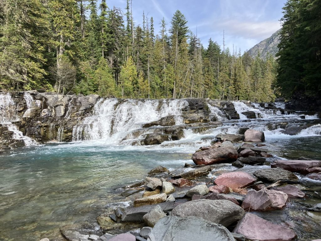
I came across Sacred Dancing Cascade, which aside from anything else iks a lovely name. It runs along McDonald Creek, which is a 25 mile river connecting McDonald Lake and St. Mary Lake. I took a short hike, crossing the river at one point, and got views from both sides.
This babbling part of the river seemed a perfect second place to release more of Bev’s ashes, and I released them directly into the river, and watched them mix with the water and swirl downstream. And the name of this section of the river, Sacred Dancing Cascade, made it even more perfect. Now, it’s more sacred than ever.


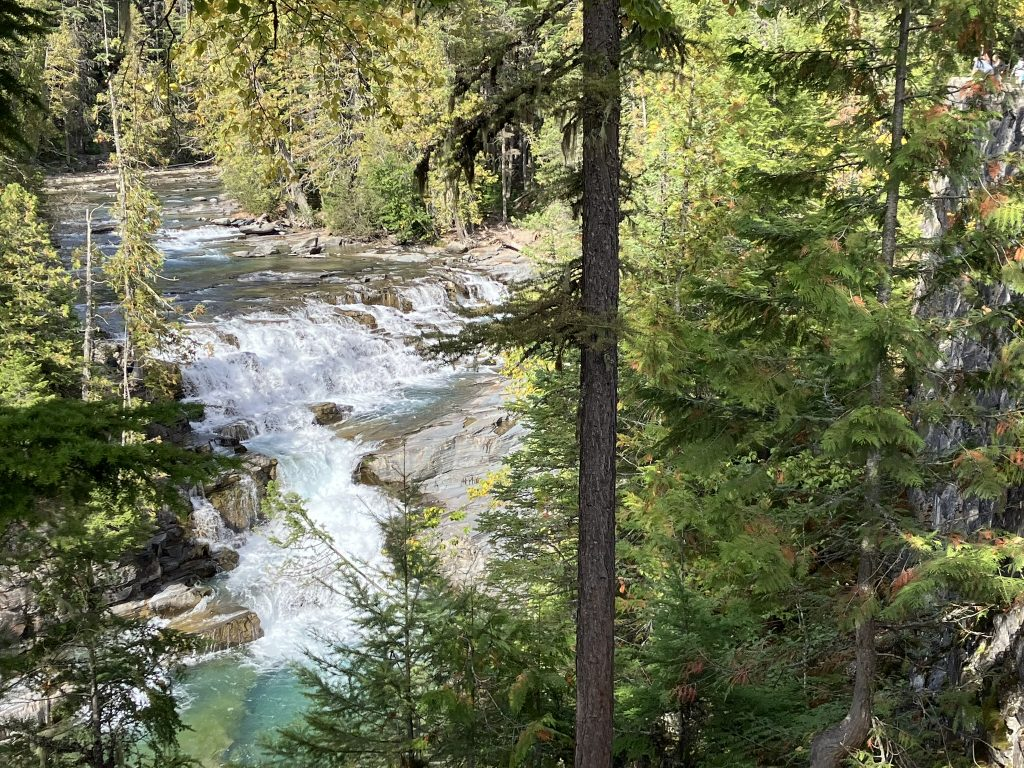
Then, I got to McDonald Falls, another beautiful and tranquil spot, where you could sit and just watch the river flow
I finally found a rough and mostly dirt road trail off Going to the Sun road, that headed to the Apgar Lookout Trail, which looked enticing. I thought maybe this was a hike I could take now I had water (and bear spray). But at the end of this rough off road, I found the trail was over 7 miles long and strenuous, and not only was that too long (takes over 4 hours to walk it), but at this point I really didn’t feel like strenuous.

Okay, I admit it; I could have walked a ways along the Apgar Lookout trail and turned back without going the full distance, but I didn’t. Instead, I headed back to the main road, continued heading south and passed McDonald Lake, which is the largest lake in the park, looking quite dramatic at this time of day.
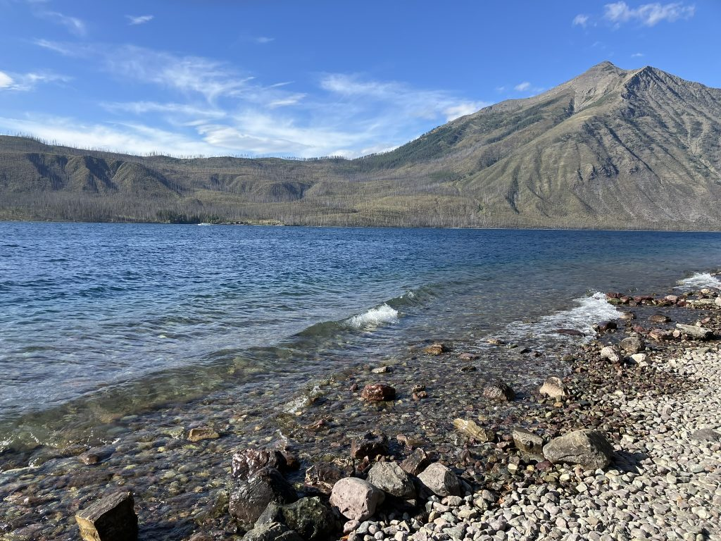

McDonald Lake is about 42 miles south of the St. Mary entrance, and as it was starting to get late in the afternoon, I headed back to St. Mary lake, going back over Logan Pass, and from there the remaining 18 miles back to St. Mary, and from there heading back to Cut Bank, arriving around 7-ish.
